SAGT News 2026
SAGT and the Deep Time Trail, Siccar Point in Berwickshire
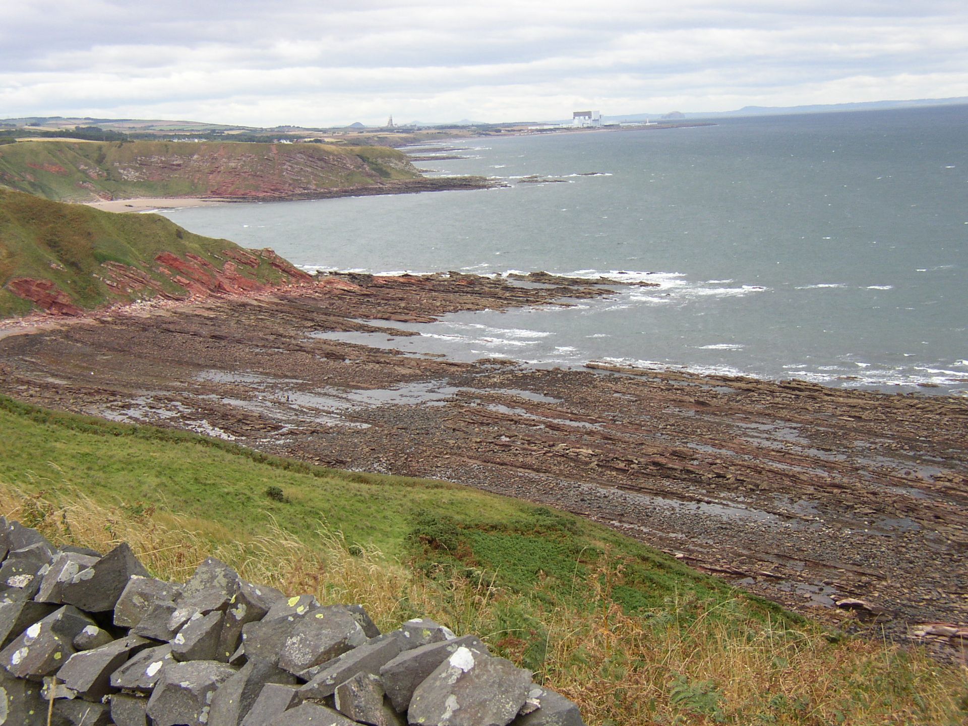
Situated on a magnificent stretch of coast in north Berwickshire, is one of the most iconic sites in geology. It is the first site listed of the 200 UNESCO Global Geoheritage sites, and there is good reason for this.
In 1787, James Hutton took two companions along this coastline by boat, predicting that he would find a junction where gently inclined strata of red beds overlie almost vertical beds of grey beds. He did indeed find such a junction at Siccar Point.
Hutton reasoned that the grey rocks were originally deposited as horizontal beds, had been heaved up and tilted into a vertical position and subsequently worn away by exposure at the Earth’s surface, and then the red beds were deposited on top. Hutton argued this process must take such a long time that, given he had seen numerous junctions across Scotland, it must mean “There is no vestige of a beginning and no prospect of an end.” This was a radical idea in his day. One of his companions on that trip to Siccar Point, John Playfair, wrote “The mind seemed to grow giddy by looking so far into the abyss of time.”
What they observed was proof of Hutton’s ‘Theory of the Earth’ which proposed an idea we now call ‘the rock cycle’, and which now forms the basis for our modern understanding of geology and geological time. Nowadays, this sort of geological junction is termed an ‘unconformity’.
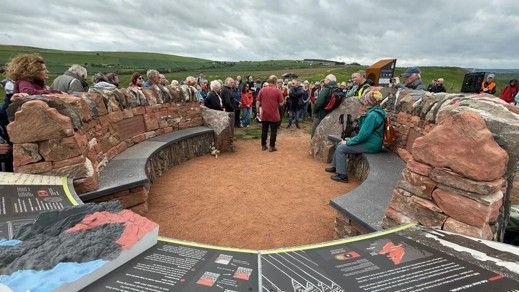
Until recently, viewing this spot where Hutton showed ‘proof’ of his theory was only accessible by a sheep-track of a footpath. To mark the tercentenary of Hutton’s birth, an appeal went out to help fund the creation of a ‘Deep Time Trail ’at Siccar Point that would provide easy access to view the site and explain the story of its ‘discovery’ and significance.
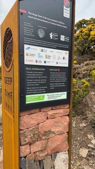
SAGT made a contribution to that fund - even though the site is not in our region its importance to the development of geological understanding was considered to be so great that a Deep Time Trail could “advance the education of the public in the field of geology”, as an organised geological walk that would “increase the knowledge and understanding of earth sciences, geology, geomorphology, geodiversity and landscape.” These aims are at the heart of the charitable objectives of SAGT.
The Deep Time Trail was launched on Friday 29th May 2026 and is now open for the public to visit.
Click on the adjacent link for details
We hope that it will attract visitors from far and wide, and from the South Yorkshire region, to visit this very important geoheritage site and take in the wonders of geology alongside the magnificent coastal landscape. It will only help people appreciate the geodiversity of the SAGT region and the work that SAGT does.
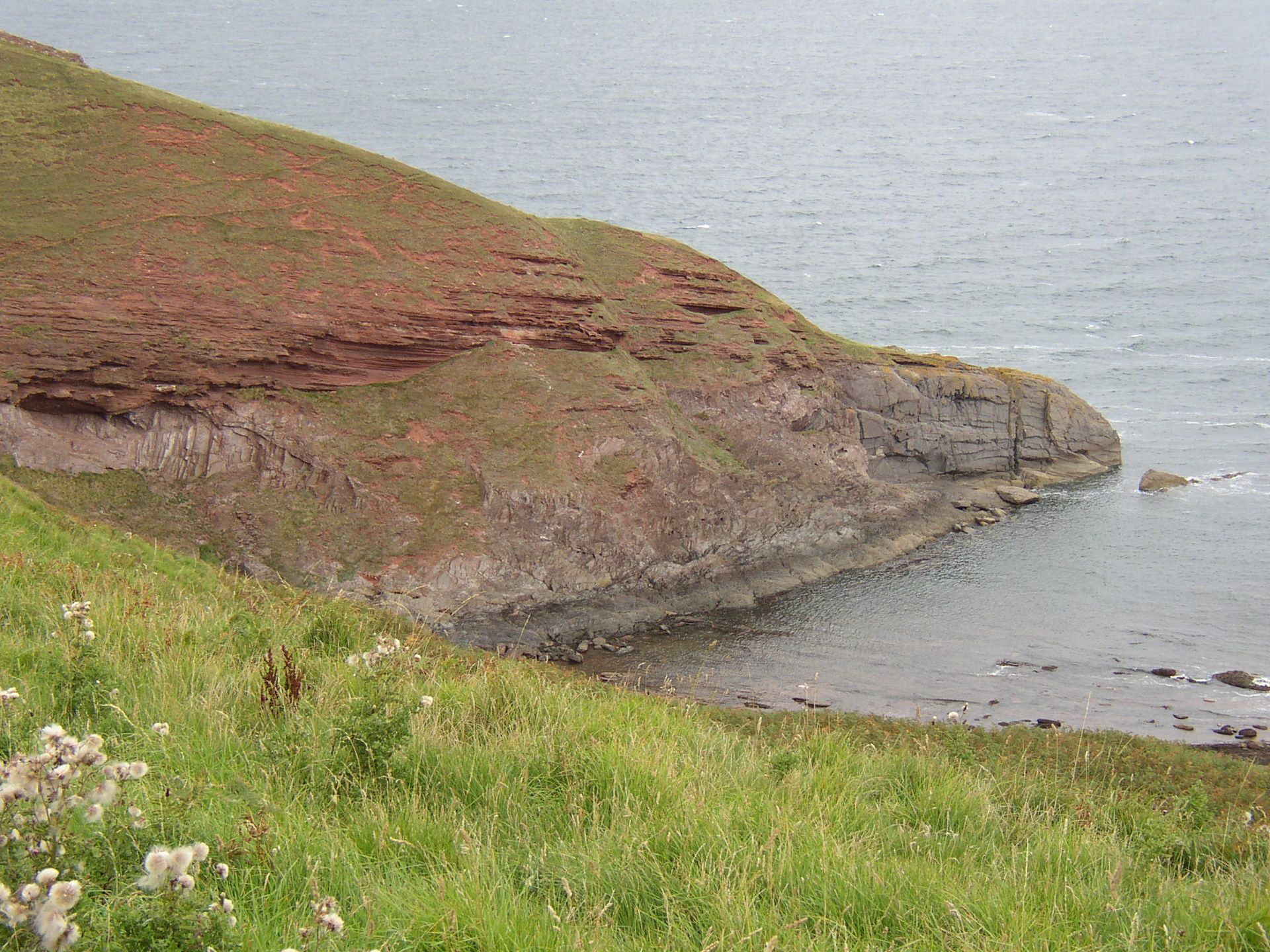
The Siccar Point unconformity - Photos: Courtesy of John Hunter 2010
Sheffield City Centre Geology Walk - Saturday 16 May 2026
There is a wonderful selection of different types of rocks in buildings, pavements, sculptures and architecture in Sheffield City Centre. Some of these are of local origin, whereas others have come from far away. During the walk, which will be about 1.5km long, the identification, origins and performance of rocks will be described. Meet at 2:00pm at the Women of Steel Statue outside the City Hall, Barkers Pool, Sheffield, S1 2JA. (No need to book)
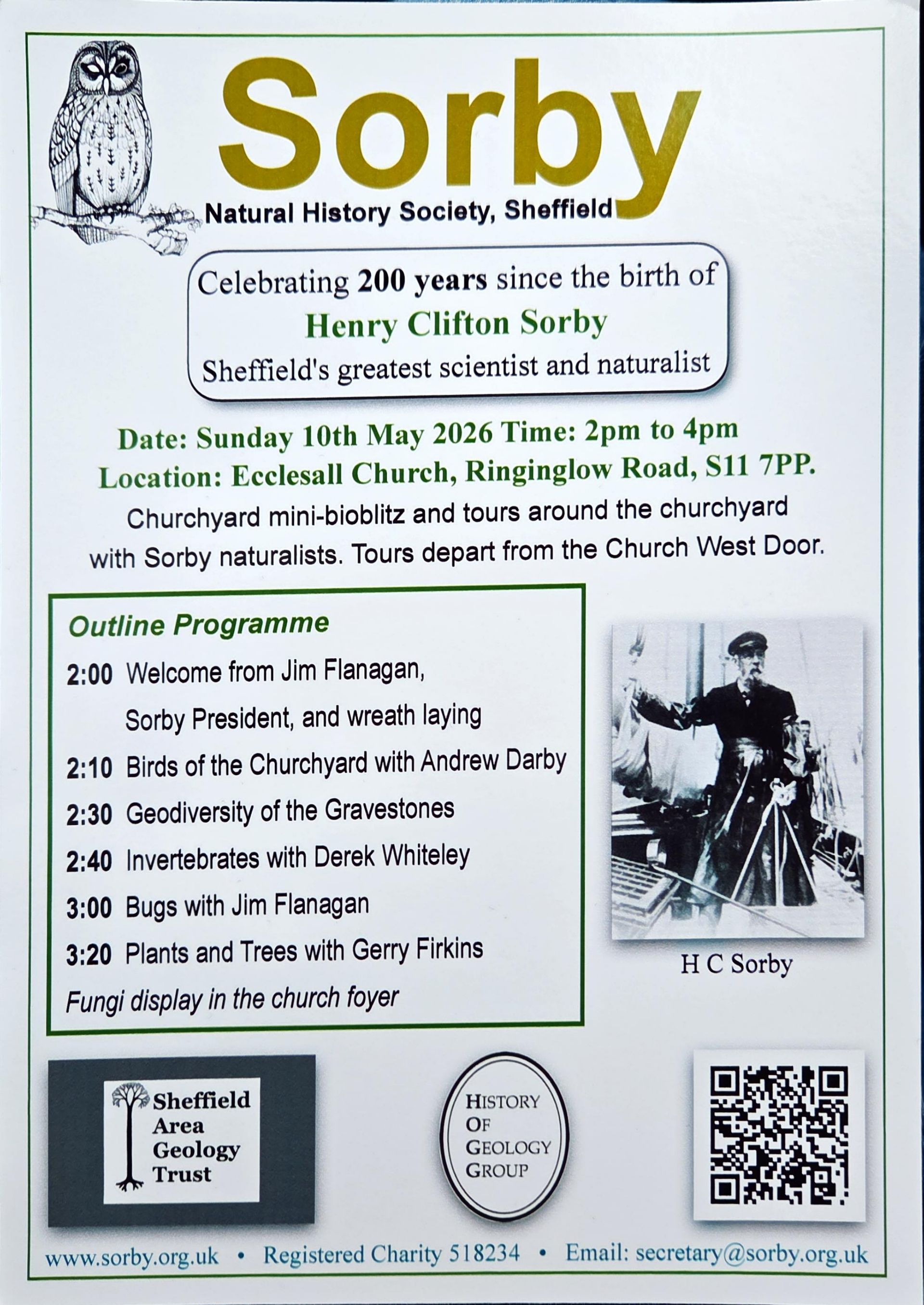
Celebrating Henry Clifton Sorby - Sunday 10 May 2026
A good many people turned out to commemorate Sheffield's greatest geologist and last great gentleman polymath, Henry Clifton Sorby (10 May 1826 – 11 March 1908).
A crowd of all ages attended the birthday bicentenary wreath-laying event at his graveside, at All Saints Church, Ecclesall, with the Sorby Natural History Society & History of Geology Group.
Sorby's tomb is a kerb & plinth of 'Brincliffe Blue' sandstone (a highly-prized variety quarried less than a mile away), a base of Scottish Rubislaw Granite and a gable top of Peterhead Granite; with the Sorby monograph on one end and Christian 'IHS' the other. The grave is in a prominent location aligned with the church west door and altar - a position that was probably influenced by Sorby's spiritual faith and beliefs!
You can read about the life and achievements of Sorby by clicking on the link to our 'Notable geologists' webpage
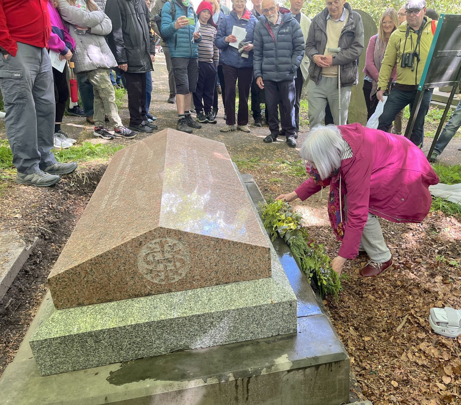
Wreath laying ceremony
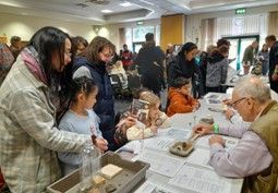
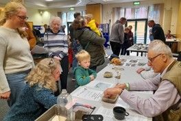
The ceremony was followed by a series of natural history activities, with SAGT offering a tour of the geodiversity to be discovered in the churchyard, which drew a good and enthusiastic crowd of participants, most of whom were relatively new to things geological.
Martin Godley led them to see and learn how to identify a variety of rock types used for gravestones - igneous, sedimentary and metamorphic. They explored how the condition of the sandstone graves varied. Those made of 'Brincliffe Blue' (a variety of Greenmoor Rock) have tended to last, but other, cheaper varieties, showed significant signs of 'spalling', where layers sandstone seem to be 'peeling off'. This is caused by water frequently penetrating the sandstone rock and dissolving natural salts which then crystallise at a frequent wetting and drying depth near the surface as the water evaporates. The new salt crystals expand and build up stresses that prise off the layers.
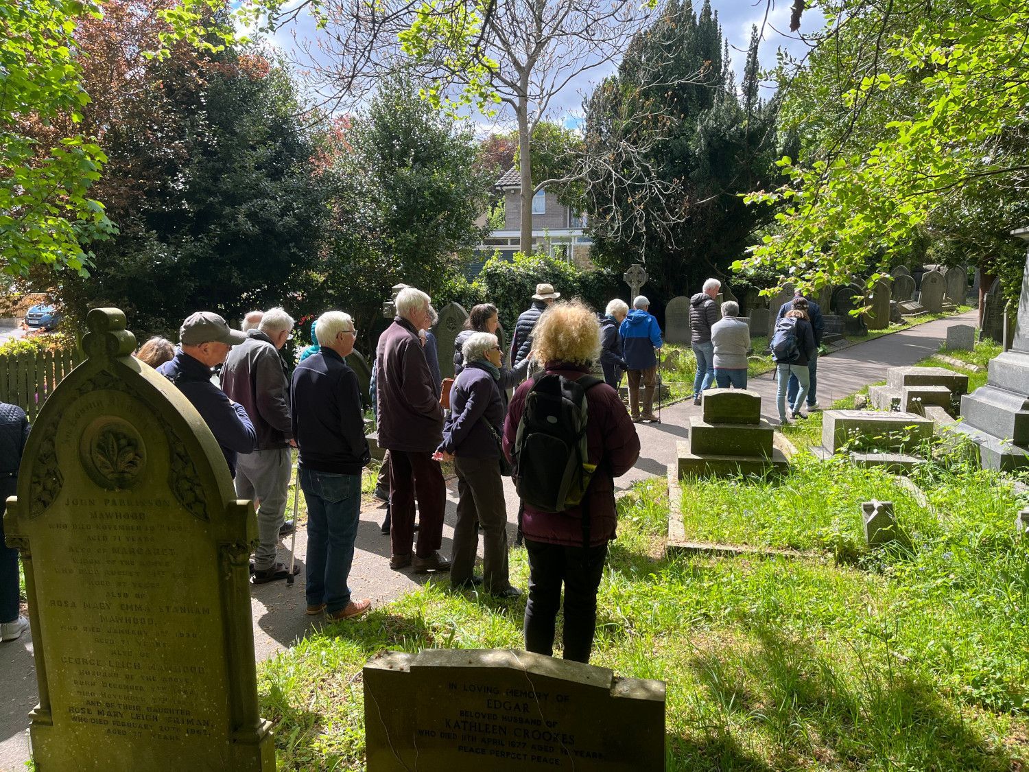
The ceremony was well attended
Martin also pointed out 'marble' tombs, such as that of the Steel family (who were part of the prominent Steel, Peach & Tozer Company), which showed signs of weathering by solution, through the once flush lead-letters now stand proud - participants were able to feel the effect of the weathering process. The group also discovered that most of the 'marble' gravestones are, in fact, made of limestone either from Portland in Dorset or, more frequently, from Wirksworth in Derbyshire. It became clear to the churchyard observers that the most enduring memorials had been constructed with various types of granite and that they were usually the most elaborate designs ordered by those people and families who had been wealthy enough to afford a gravestone that lasted throughout the years.
Interestingly en route, the gravestone geodiversity tourists spotted the grave of John Arnold, the former owner of the Brincliffe quarries. Predictably, his tomb base and platform was made of the 'Brincliffe' Blue' rock he had extracted and sold, but less expected was that the carved upper parts of the tomb's design are made of a dark gabbro, quarried in South Africa!
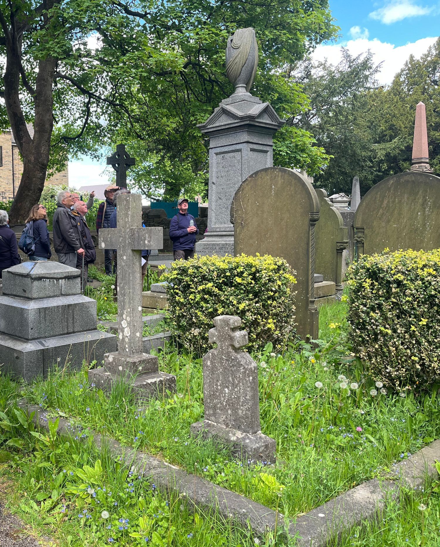
Gravestones constructed with different rock types
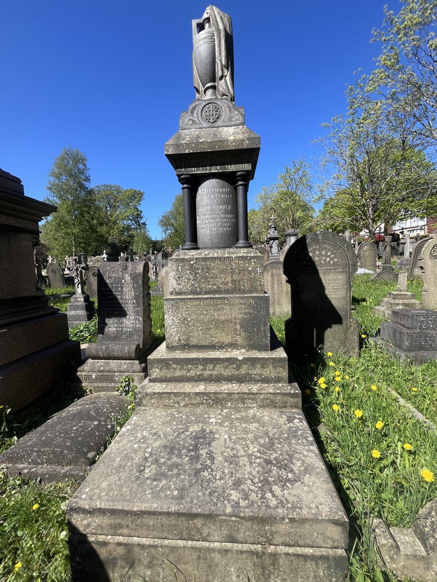
John Arnold's grave
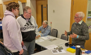
Yorkshire Geology Day - Saturday 11 April 2026
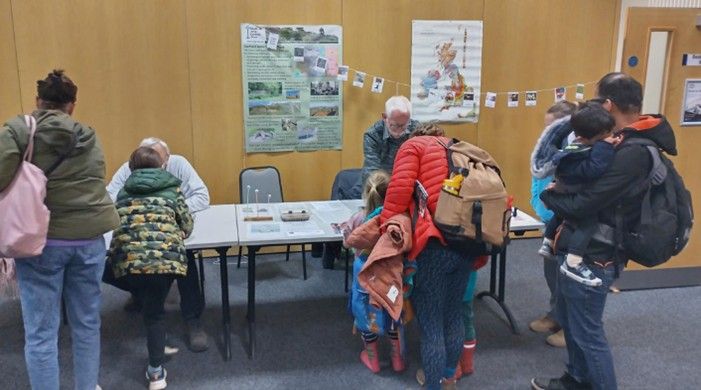
Members of Sheffield Area Geology Trust recently participated in Yorkshire Geology Day, which took place at the National Coal Mining Museum for England (Caphouse Colliery) near Wakefield on Saturday 11th April 2026. The event attracts much public attention with a regular attendance of over 1,100 people and included surface walks, talks, fossil identification and making and rock cutting and polishing.
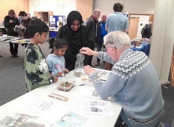
SAGT’s contribution highlighted the relevance of geology to society with table-top demonstrations of the potential impacts of earthquake on buildings, factors that affect rock strength and the problems caused by pyrite in construction. There were also examples of modern and fossilised bivalves and a demonstration of the alternative interpretations of dinosaur tracks.
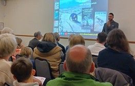
The event, which was organised by Yorkshire Geological Society, included an afternoon session in which there was a series of lectures centred on the theme of dinosaurs, including: What is a dinosaur? And Dinosaurs of the North Yorkshire coast. A large audience, including many children, were informed and entertained about The secret lives of dinosaurs by Dean Lomax who is dinosaur researcher and author of popular and academic books on dinosaurs.
This is an annual event, so it should take place at about the same time next year. Apart from this event the National Coal Mining Museum for England is a fascinating place to visit at any time it is open.
SAGT News 2025
Yorkshire Geology Day - 26 April 2025
Members of Sheffield Area Geology Trust participated in Yorkshire Geology Day, which took place at the National Coal Mining Museum for England (Caphouse Colliery) near Wakefield on Saturday 26th April 2025. The event attracted much public attention with an attendance of over 1,100 people and included underground visits, surface walks, fossil making and rock cutting and polishing.
SAGT’s contribution include some table-top simulations of earthquake damage and testing rock strength. Photos of a current construction site were accompanied by potentially problematic large selenite crystals which had grown within the shales and families were invited to discover what can be learned from the pebbles found during a stroll on a beach.
The event, which was organised by Yorkshire Geological Society, included an afternoon session in which there was a demonstration of geology and mining at Caphouse Colliey and a series of short lectures on The Rocks that Built Yorkshire, including a presentation by Peter Kennett (SAGT) on Sheffield’s Building Stones.
This is an annual event, so it should take place at about the same time next year. Apart from that the National Coal Mining Museum for England is a fascinating place to visit at any time it is open.
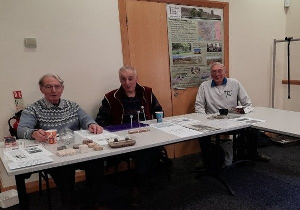
Demonstrations
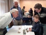
Interactions
Experiments
Explanations
