2017 News Archive
Recording, conserving and promoting the landscape and rocks of the Sheffield region
2017 SAGT News Archive
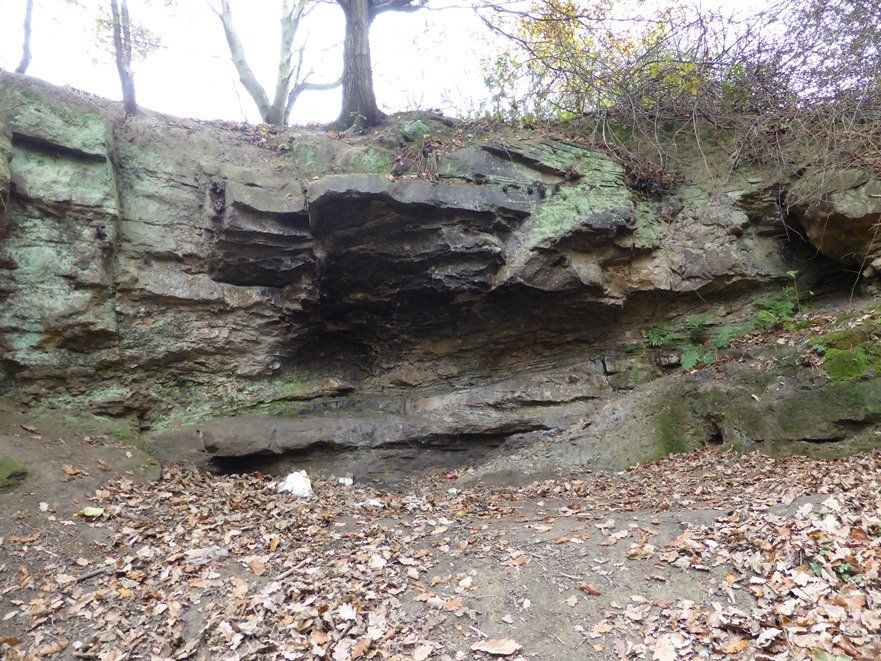
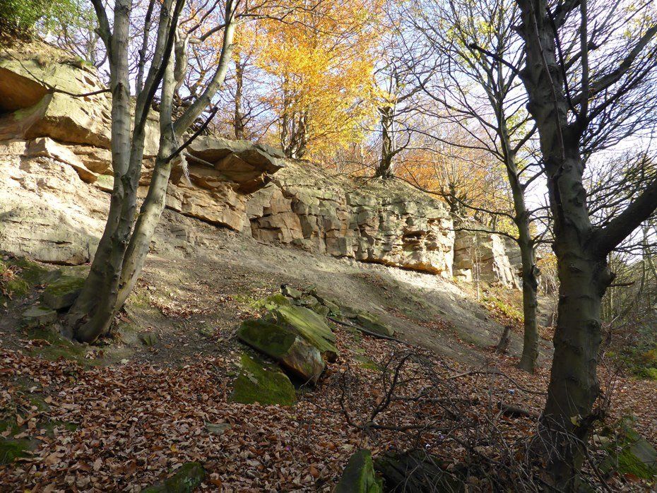
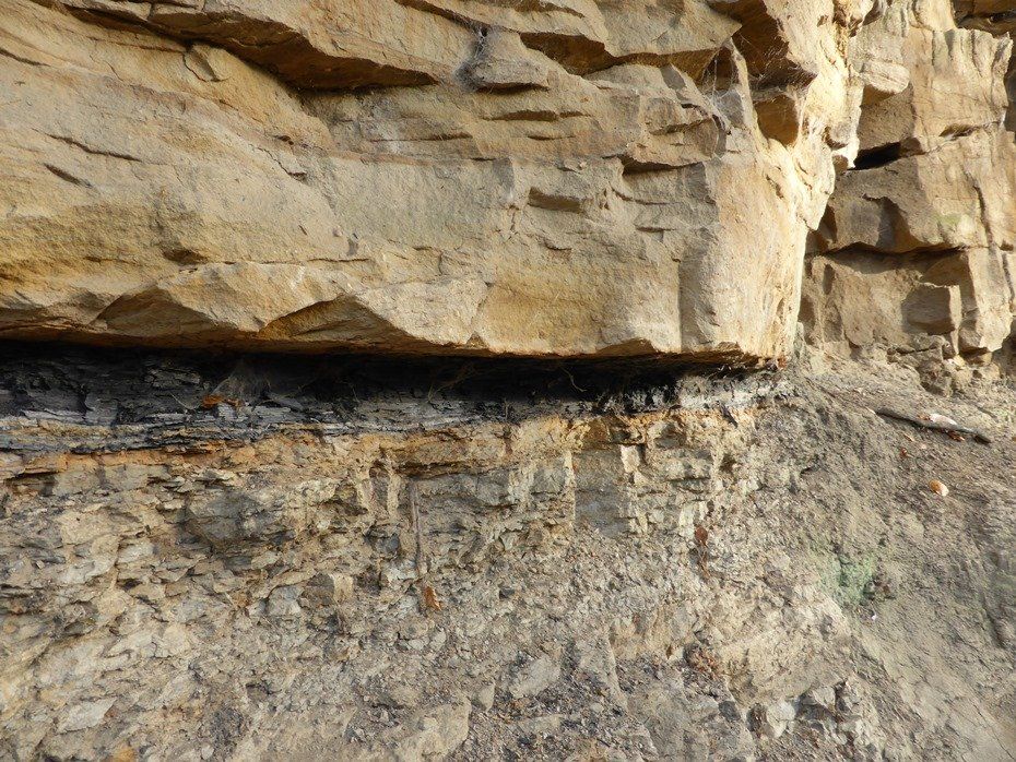
19th Century ironstone mining legacy - 8 December 2017
Rock Oddity - 2 December 2017
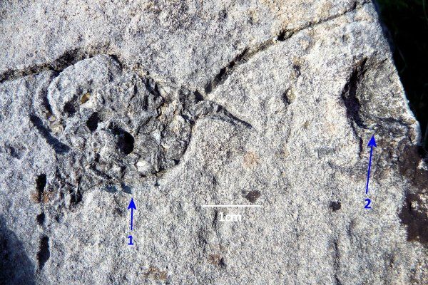
LOCATION: a loose block in a north Pennine dry stone wall.
HORIZON: Dinantian, probably Cove Limestone.
ROCK TYPE: thin bedded biomicrite.
(1) linked impressions on a bedding surface forming an enclosed, globular shape, about 3 cm across, filled with matrix and shelly debris, having thin, elongate (segmented?) protuberances.
(2) about 3 cm away, is a curved depression of almost similar size.
Fieldwork collaboration with University of Derby - 1 December 2017
Three Derby University geology undergraduates are undertaking their dissertation work under the supervision of Dr Sian Davies-Vollum and in cooperation with SAGT, as follows:
Callum Moller and Jacob Dean are both studying the distribution and sedimentology of the Greenmoor and Grenoside Sandstones in the Sheffield area from Graves Park in the south to the Greenmoor area in the north. This work involves outcrop scale analysis as well as hand and thin section petrographic descriptions. Once their analyses are complete they will compare and contrast their results with previous work.
Danny Haywood is studying the geology of the Porter Valley area including Brown Edge quarry. He is applying geological and geomorphological mapping to understand the distribution of sedimentary rocks and is undertaking a detailed sedimentological analysis of the outcrops at the quarry.
Silkstone Volcano - 29 November 2017
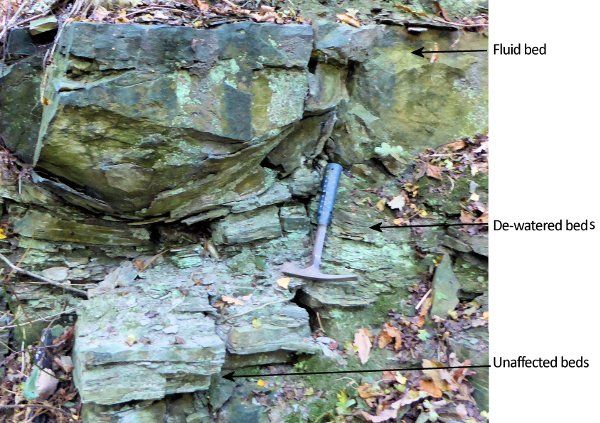
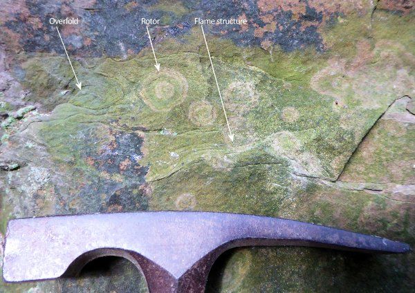
Not all volcanoes are big and dangerous. Sand volcanoes are centimetres high, and produce sedimentary features that are even smaller. This one, at the bottom of the Silkstone Rock, seems to have been formed when the weight of overlying sediment caused the grains in the beds below to settle into a tighter packing. This compaction displaced the water in those beds and bedding planes upwards into a sand volcano. The sand bed above became fluid, and now is not flat lying, but shows over-folds, rotors, and flame structures just above the "throat" of the volcano.
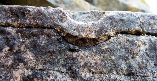
One that got away - 19 November 2017
Rock - Farm Barn
Rock - Farm Barn sketch
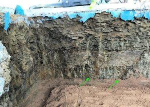
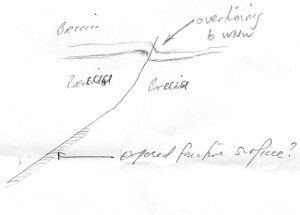
SAGT got a call about a "strange rock in a barn wall". The photograph looked interesting, but it was unclear, and by the time we got there the builder had concreted it. Luckily they are a sharp-eyed bunch and we got a good description - and another photo.
There is a sharp, curving surface in an 80 cm high vertical section, striking 215N (more or less") dipping to SE and disturbing and brecciating the Greenmoor Rock. To the west, 100m away, is a large normal fault down-throwing SW and striking NW-SE. We're still working on it.
Site inspection visits near Rotherham - Thursday 16 November 2017
Four SAGT members made site visits to two designated RIGS (Regionally Important Geological Sites) in Rotherham on Thursday. Both are abandoned historic quarries.
Great Bank Quarry
The rocks exposed at Great Bank quarry are the only outcrops within Rotherham district of a thick bed of sandstone called the Dalton Rock. This sandstone forms a resistant caprock bed on top of a long, thin, mesa-like hill that projects northwards towards Dalton Parva because Dalton Brook has eroded a valley through its western side. Brecks Lane runs along the top of the mesa and Dalton Parva is built on its northern tip. The Dalton Rock has not been found underground in any colliery shafts or boreholes. Cross-bedding measurements made by SAGT at Great Bank indicate that the river which deposited the sand flowed unusually in a northwesterly direction at that point. The quarry at Great Bank does not appear to have been worked since 1850.
Silverwood
The cliff-like rocks exposed at Silverwood were the result of excavations made in the early twentieth century when the bottom of the brook was widened to accommodate railway sidings associated with Silverwood Colliery. This site is the best of of three known outcrops of a sandstone bed called the Ravenfield Rock in the Rotherham area. It is also the highest sandstone bed of the Carboniferous Coal Measures preserved beneath the Permian unconformity in this area. The basal contact between the sandstone and the underlying mudstone rock is revealed along the base of the cliff, a feature which is not often seen.
Sheffield General Cemetery - 13 & 14 November 2017
Sheffield General Cemetery
A SAGT member led two groups of 30 Year 3 children from Greystones Primary School in investigating the geology of gravestones in Sheffield General Cemetery on 13th and 14th November.
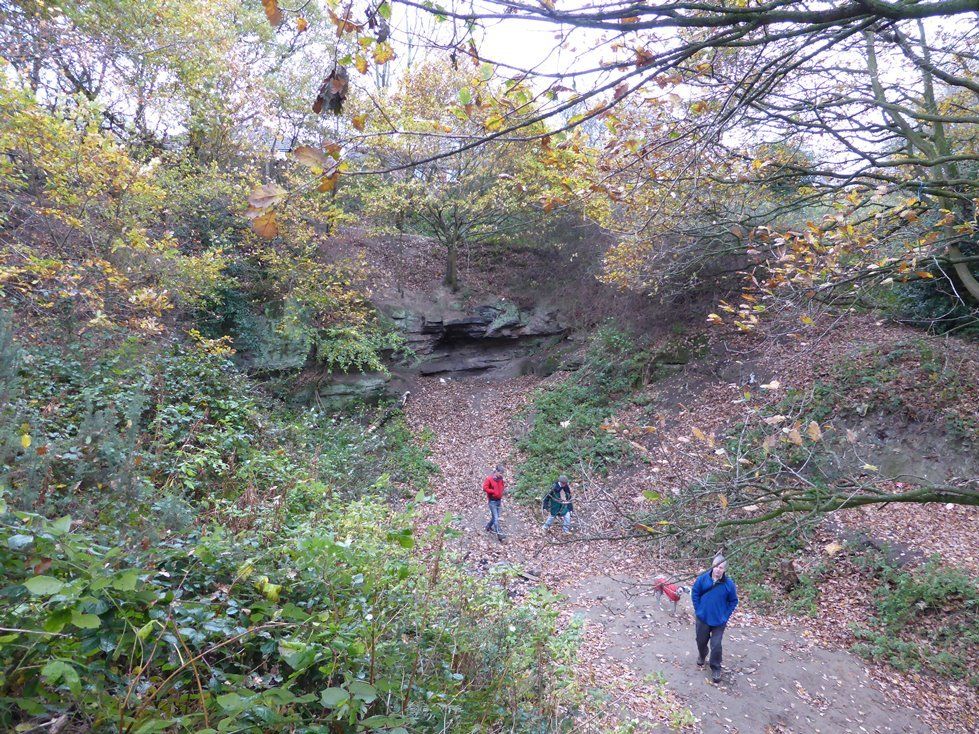
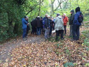
The Old Mines of Greystones Cliffe - Saturday 4 November 2017
Discussion of old bell pits in Porter Valley
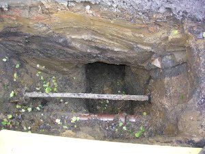
A temporary exposure of an old mining gallery in an excavation for a new lamppost
Peter Kennett led a geo-walk on behalf of the Friends of the Porter Valley. 21 people attended the walk around the former mining area of the High Storrs Roughs and Greystones Cliff on 4th November. The geology of the Porter Valley floor revealed glimpses of Namurian and Westphalian sandstones, some of them cross-bedded and tilted.
A tight monocline exposed in the stream banks near Forge Dam is probably the result of valley bulging. Duncan McLean identified fossil casts of Calamites
roots, which were found behind the former Leather Wheel dam.
Survey of Permian rocks around Roche Abbey - 28 October 2017
SAGT conducted a preliminary field survey of several sites around Roche Abbey and the Maltby Dike valley. This was needed because the information the SAGT database holds on these sites was over 10 years old, and because the Permian Limestones (Dolostones) are always interesting to see, especially on a warm autumn day, in one of the strangest (but pretty) valleys in the area.
Oh, and there was a 12th century abbey lying about somewhere between the exposures.
These beds were all in the Cadeby Formation, and lie just above the basal unconformity, which is nowhere exposed, sadly. They record events shortly after the Zechstein Basin flooded in over the East England Shelf. Thick units of pisolitic beds alternate with a range of fine grained and laminated limestones, with tantalising hints of burrows, and even one place looking suspiciously like Hummocky Cross Stratification. There are patches of the Basal Permian Sands in the area, but none at the sites visited.
A further visit is planned, but if you want to know more about the Permian in our area, go to the Permian page
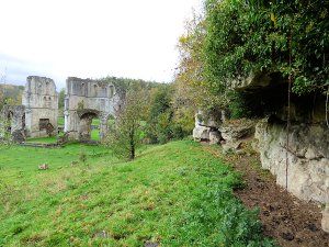
Roche Abbey Crag South View
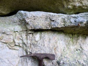
Base of a pisolitic bed
